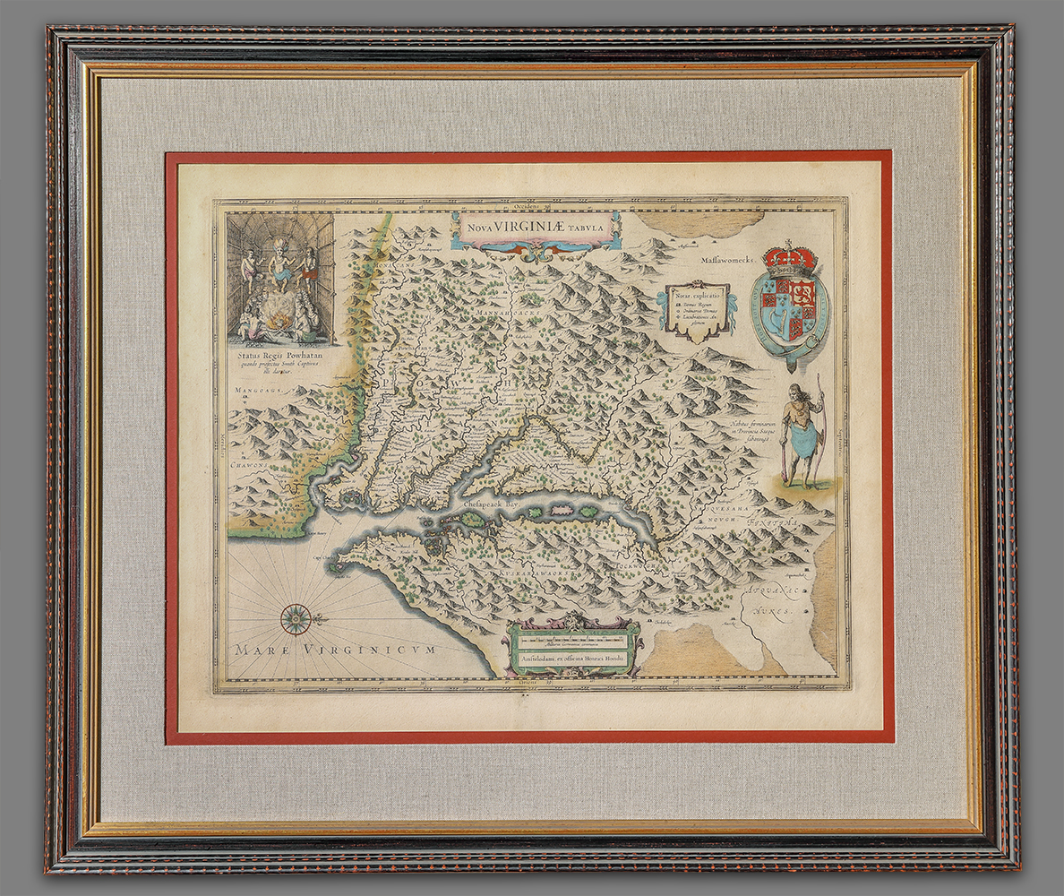
Nova Virginiae Tabula
Artist/Maker
Smith, John __Cartographer ||Hondius, Henry __Publisher
Place Made
Amsterdam Netherlands
Date Made
1633
Medium
ink and watercolor on paper
Dimensions
HOA: 18″; WOA: 22″ (sight), Unframed
Accession Number
4373
Description
This map is a copy of John Smith’s 1612 map of Virginia which was engraved by William Hole. Smith’s map has been noted as one of the most important and influential early maps of Virginia and was copied by a number of early publishers including Henrici Hondii (also seen as Hendrick Hond, Hendrick Hondius, and Henricus Hondius) The orientation of the map with North to the right is not an unusual feature of early maps.
The figure of the Susquehanna warrior is most likely taken from similar image of the “Weroan or Lorde of Virginia” that was published in 1590 by Theodore De Bry in Thomas Hariot’s “Brief and True Report of the New Found Land of Virginia,” which included engravings based on the sketches made by John White during his 1585-1586 residence with the colony on Roanoke Island. ACC. 5851.3.
Above the warrior figure is a small table clarifying the “Signification of these markes, / To the crosses hath bin discoverd / what beyond is by relation” Indicating the points to which Smith had made his own “discoveries” and beyond which he was dependent on information provided by the native people who served as his guides and informants. The table also indicates symbols for “King’s howses” and “Ordinary howses.” Smith’s map recorded ten Indian tribes and 166 Indian villages in Tidewater Virginia at that time.
DESCRIPTION: Map of Virginia oriented with north to the right; inset of chief Powhatan’s council chamber in upper left corner; title at top center; key to structures and heraldic motif in upper right corner; illustration of a Susquehanna Indian at center right side; map is illustrated with topographical features, labeled with the names of settlements, waterways, etc., and colored with watercolors. On back is a description in French entitled, “DESCRIPTION DE LA VIRGINIE.” Although the map with the description printed on the map is one piece, a paper seam is glued between the two printed “pages” on the back of the map.
EDITION AND STATE: According to historian and collector Carolyn McNamara the French language, the page 697 and word “peu” verifies that this is derivative 5, State 1, of the French edition of this map printed in 1633.
REFERENCES: Burden, The Mapping of North America, 228
Tooley, Mapping of America, pg. 166
Prichard and Taliferro, Degrees of Latitude, 5.
History
According to Tooley, this state was used in all editions of the Mercator-Hondius atlas published after 1633.
Credit Line
MESDA Purchase Fund