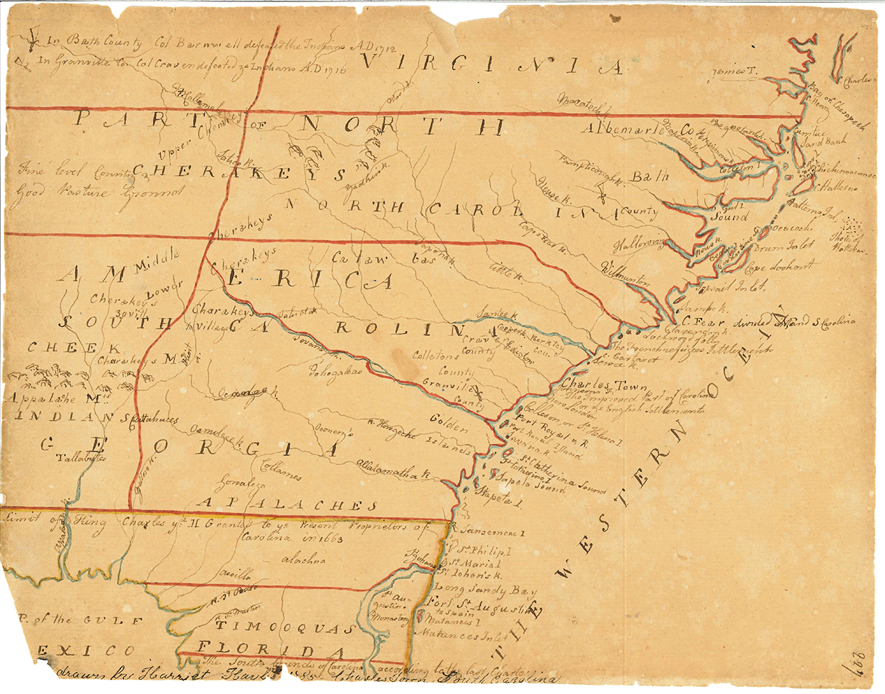
Map of the South
Artist/Maker
Hayles, Harriet
Place Made
Charleston South Carolina United States of America
Date Made
1795
Medium
watercolor and ink on paper
Dimensions
HOA: 7 3/16″; WOA: 9 3/16″
Accession Number
2351
Description
DESCRIPTION: a) Hand-drawn map of the southern states. b) hand-written description of map
History
SOURCE: The map as well as the description, though drawn in 1785, are copied from a much earlier map by the London cartographer Herman Moll. The name “Charles Town” as well as the descriptions were out of date by 1785.
MAKER: Harriet Hayles (c.1783-1799) was the daughter of Robert Hayles, a planter on the Santee River, and his first wife, Susannah Richardson. She had two sisters, Sarah and Eleanor, and a step-brother Thomas Jefferson. Harriet drew the map in 1795 when she was 12 years old. At age 16, in 1799, Harriet died and was buried at St. Philip’s Church in Charleston.
Credit Line
MESDA Purchase Fund