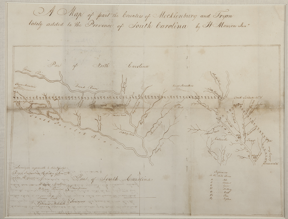
A Map of Part of the Counties of Mecklenburg and Tryon…
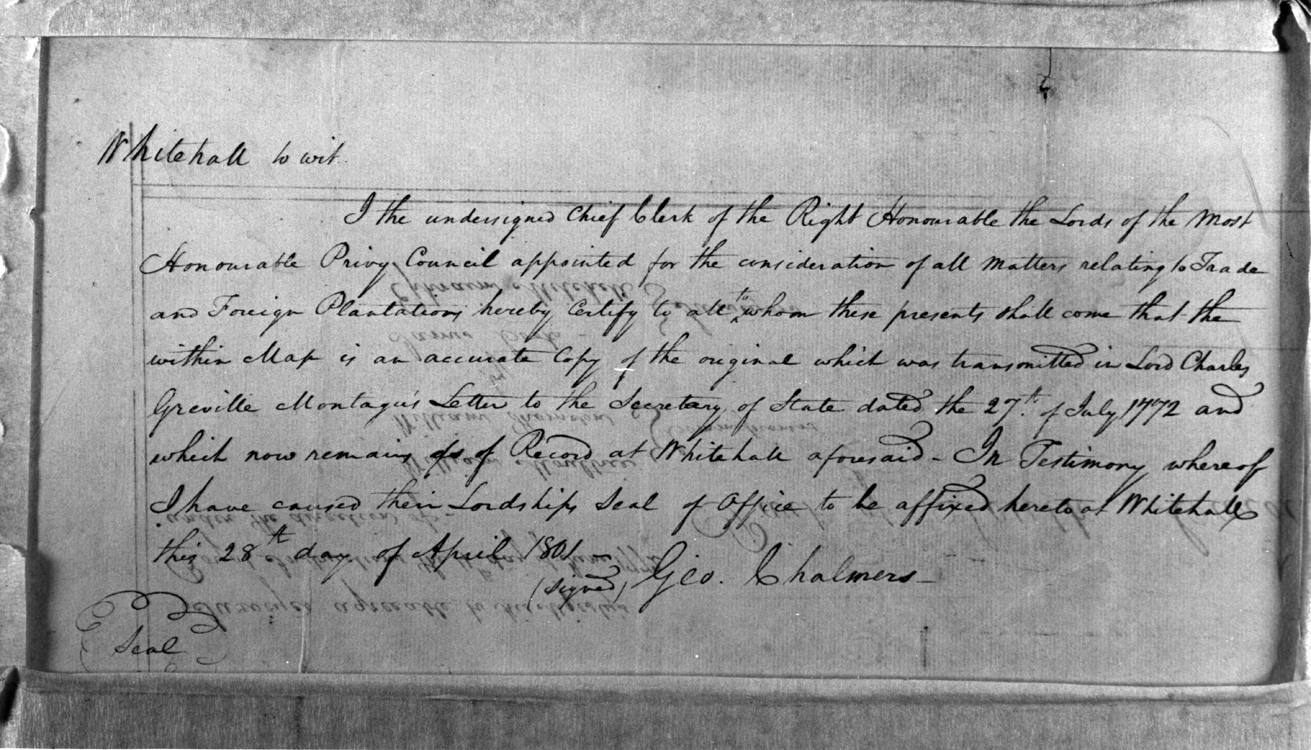
In 1801 at least two copies of this survey were made and certified by George Chalmers as Clerk of the Privy Council. In addition to the MESDA copy, another copy is at the South Carolina Archives.
INSCRIPTIONS: Top of map: A Map of part the Counties of Mecklenburg and Tryon/ lately added to the Province of South Carolina by H Mouzon Junr.
Lower right hand side: References/ To the Mile Trees/ A – Ash/ C – Chestnut/ G – Gum/ H – Hickory/ O – Oak/ Pi – Pine/ Po – Poplar
Lower left hand side: Surveyor agreeable to His Majesty’s/ Royal Instruction the 4th day of June 1772/ under direction of-/ William Moultrie/ William Thomson/ (to the right of these names is the word “Commissioners”)/ James Cook/ Ephraim Mitchell/ (to the right of these names is the word “Surveyors”).
To the right hand side of the above paragraph: Part of South Carolina
DESCRIPTION: Map focusing on rivers and creeks in the Catawba region, line across map with initials on it, and a small inset of the Catawba tract on the right hand side. Discoloration, folded and a tape mark.
REFERENCE: Cumming, The Southeast in Early Maps, 404.