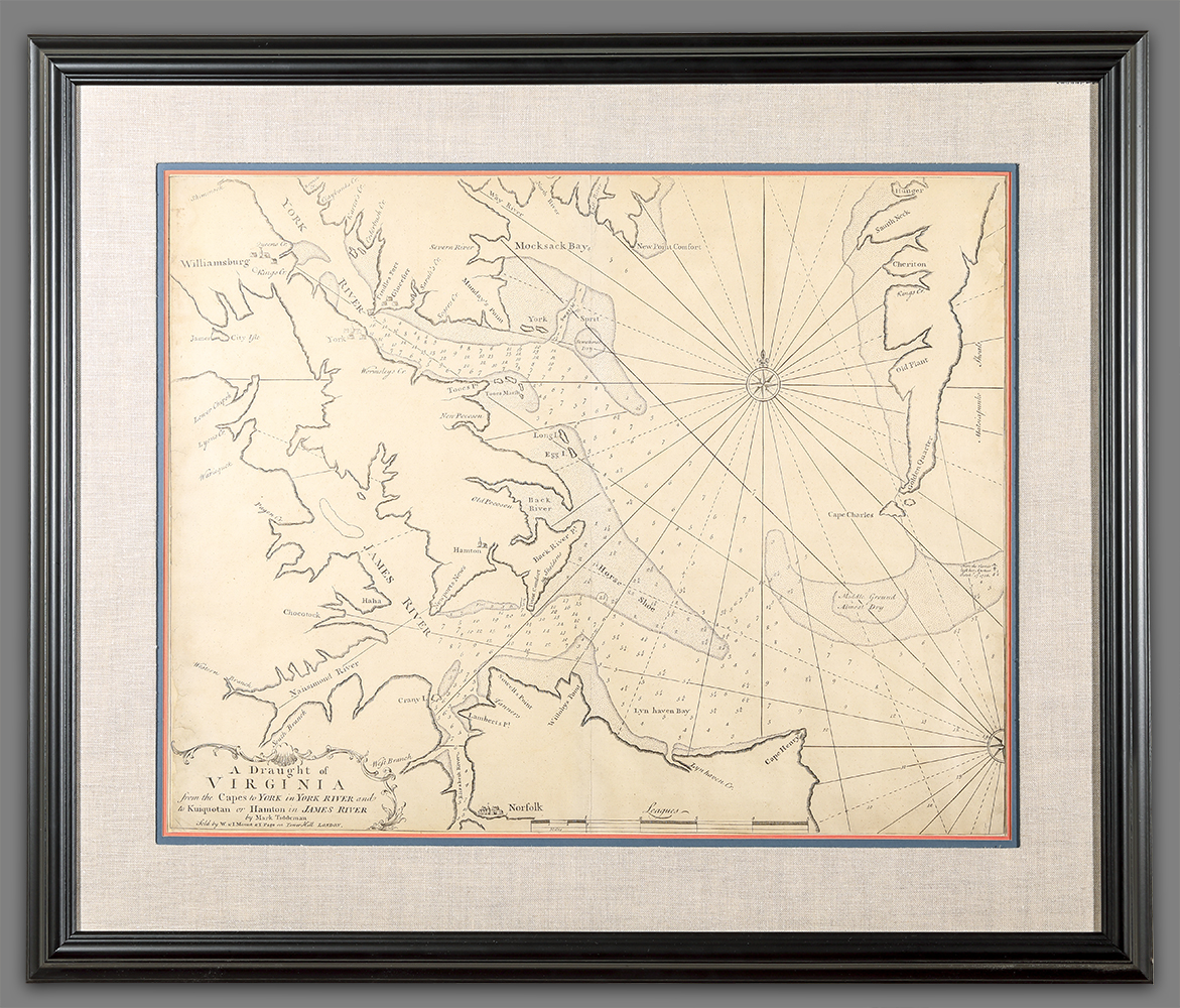
A Draught of Virginia…
Artist/Maker
Tiddeman, Mark
Place Made
London Great Britain
Date Made
1773
Medium
ink on paper
Dimensions
HOA: 18 1/2″; WOA: 23 1/4″ (approx)
Accession Number
3923
Description
A navigational chart depicting the southern part of the Chesapeake Bay. The depths marked on this map were meant to aid sea captains navigating their way into the Chesapeake Bay and up the James and York Rivers to ports like Norfolk, Newport News, and York(town).
This map went through at least eight editions, beginning in 1737. This copy is the sixth edition.
DESCRIPTION: Copperplate engraving of map showing the shoreline of southern Virginia, showing Williamsburg, Norfolk and York; the James and York Rivers; several bays, islands, creeks and small settlements. Two compasses with radiating lines.
History
This map is was issued as part of the The English Pilot (London: for W. & J. Mount, T. Page & Son, 1773).
Credit Line
Given by Mr. Thomas Gray in memory of Mr. Harrison Lassiter